Destin to Apalachicola

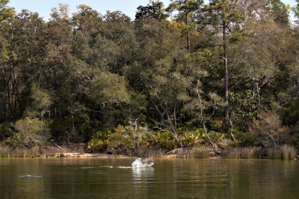
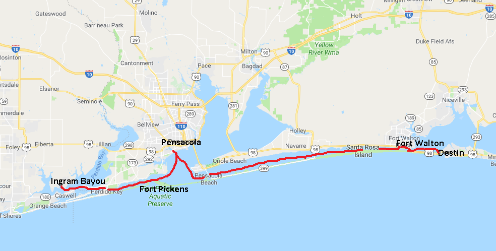
The bad weather had passed, so we moved on from Destin and anchored at the eastern end of Choctawhatchee Bay. The waterway then passes into a narrow cut known as the Grand Canyon, before going into West Bay and Grand Lagoon.

Destin to Apalachicola
Mile 255, looking west

The Grand Canyon
Dump truck
The waterway widens out just before West Bay

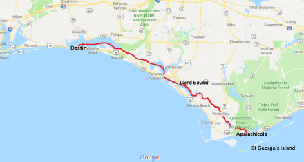
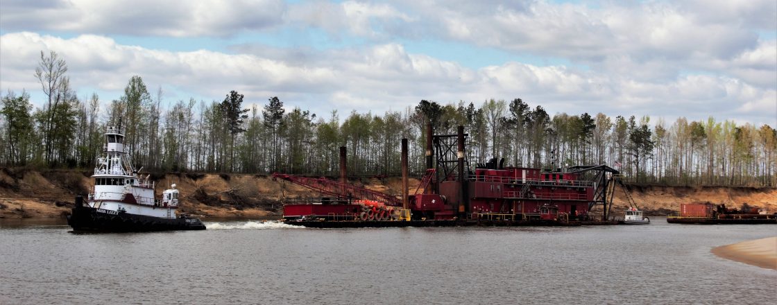
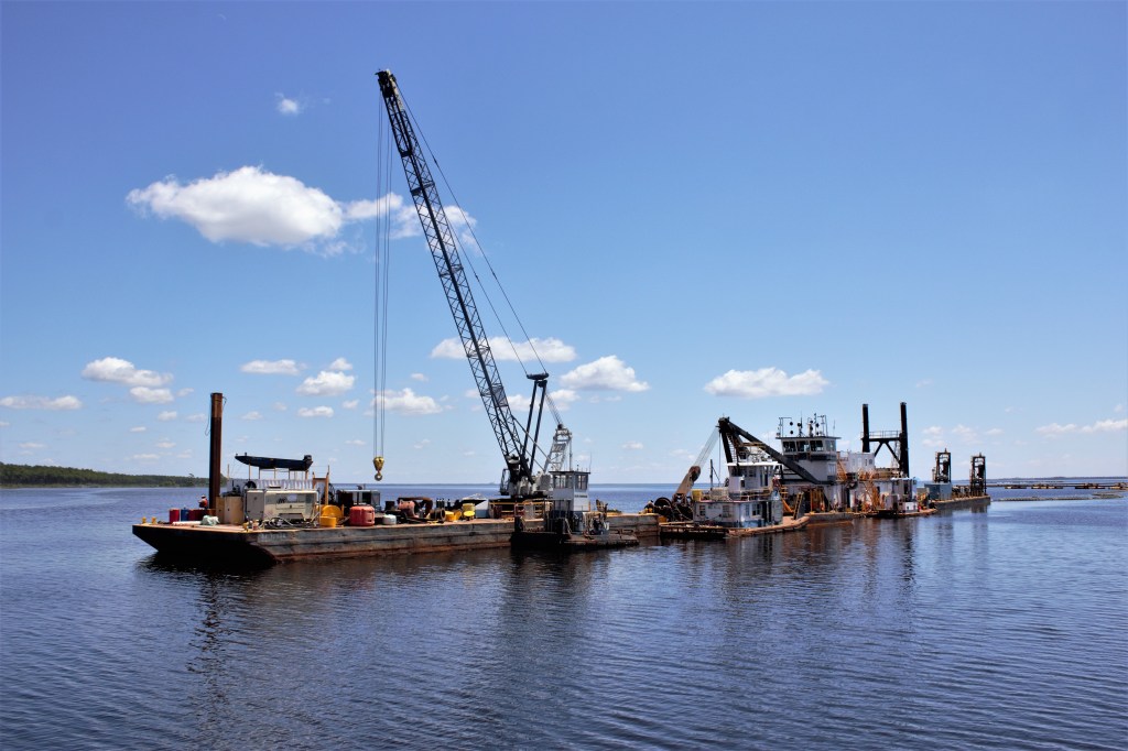
We were approaching Panama City and the area which had suffered the most devastation last October when Hurricane Michael struck. We saw lots of damage to property and vegetation. In West Bay, dredgers were busy clearing the channel.

Dredger in West Bay

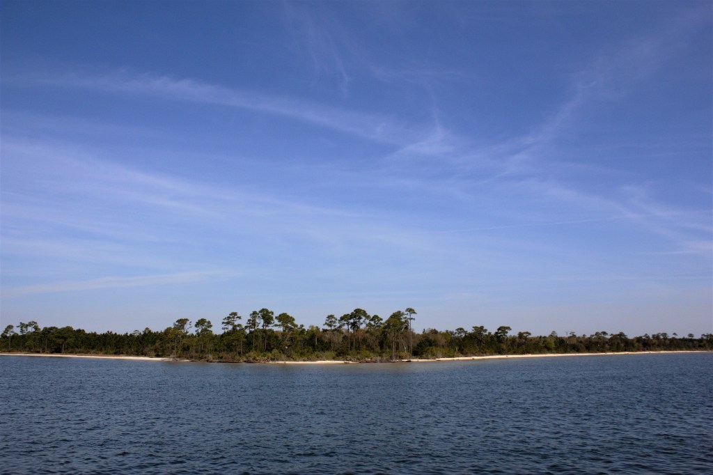
Ian had identified a suitable anchorage, listed in Skipper Bob’s Cruising Guide, at the far end of East Bay. But he decided we had time to go farther on, so that the next day’s cruise would be shorter. Instead of Skipper Bob’s anchorage, we would stay in a wide, unnamed bay on the southern shore of East Bay, which Skipper Bob had clearly overlooked.

The bay was windy and exposed, but we dropped the anchor anyway. I noticed three little planes with a rather pugnacious appearance pointing straight at us, and a check on the GPS confirmed that we were a few yards outside a high security zone. This was a little unnerving, and a few minutes later, another check on the GPS showed that we were actually drifting.

The anchor had to be pulled up, and we motored a short distance further away from the planes, and dropped the anchor once more. It was gin and tonic time, but we didn’t relax for long. We were drifting again, and Ian didn’t improve matters by knocking his gin over.

I suggested in a firm tone that it might be better to go to the nearest recommended anchorage. 40 minutes later, we found ourselves safely moored in Laird Bayou. A lesson had been learned, and it was that if an anchorage isn’t recommended by Skipper Bob, it ain’t recommended.

Evening at Laird Bayou

But tomorrow’s another day. Some mornings, you wake up early, and it’s just too nice to stay in bed.

Early morning at Laird Bayou

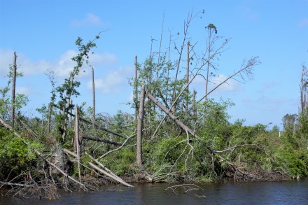
It was the promise of a fine day ahead. We left Laird Bayou for Apalachicola, out of East Bay and along another narrow cut, where the hurricane damage was all too apparent, through Lake Wimico and into the Jackson River and the Apalachicola River.

Hurricane damage
Mile 331, GIWW

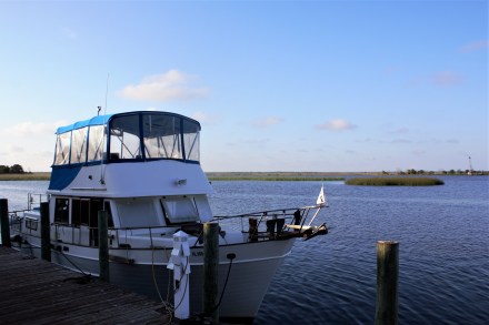
We stayed 3 nights in Apalachicola, the first night in the marina on the riverfront, and the last two on the municipal dock, a few yards away, as the marina had no space. But George, the marina owner, kindly let us use the golf buggy to get to the supermarket to restock our depleted supplies.

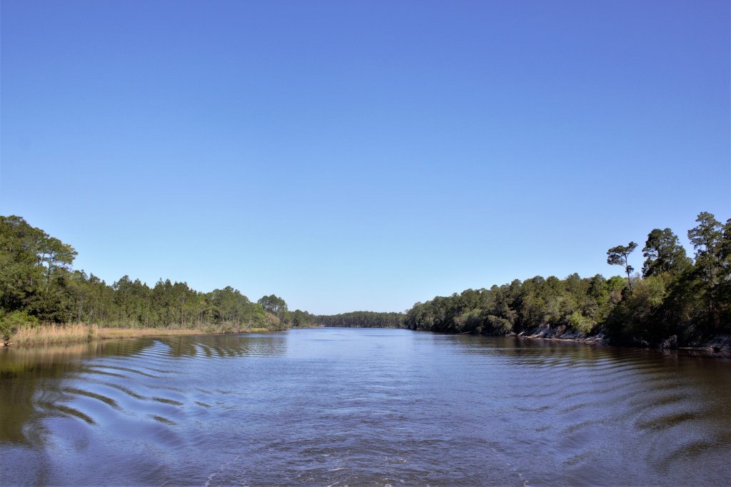
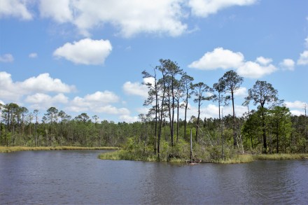
Our mooring looked out over the swampy estuary of the Apalachicola River.

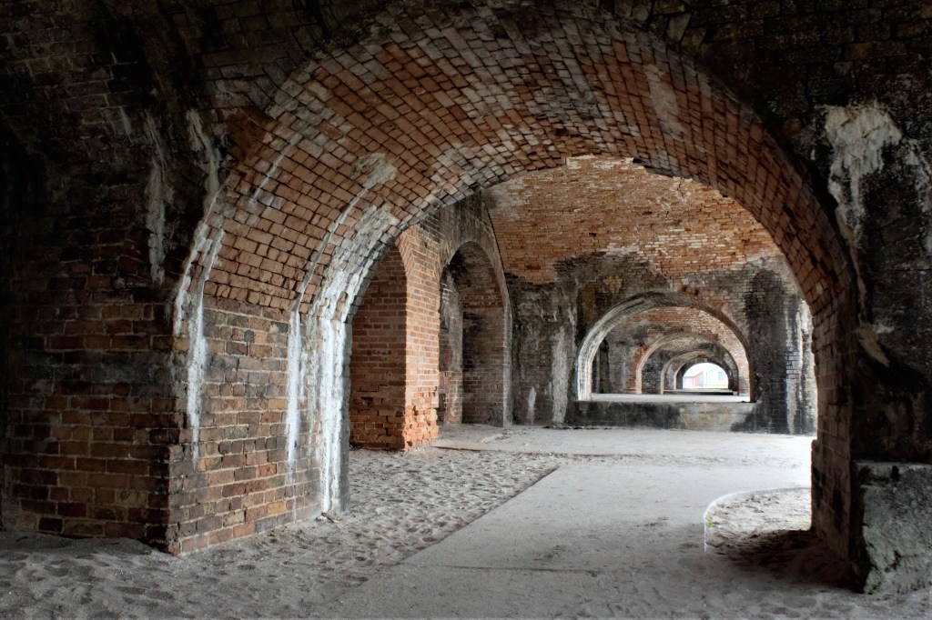
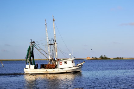
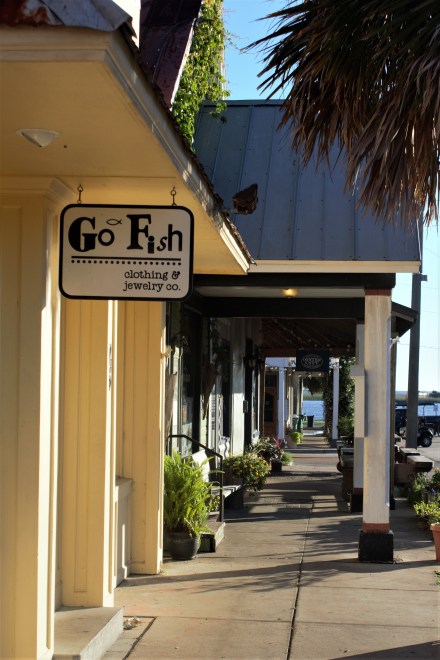
Apalachicola had been an important port for exporting cotton from all over the region, before the railways were built and transport by rail became more cost-effective. On Water Street, facing the river, there were once many brick warehouses, of which a few remain, converted into shopping malls and holiday accommodation. There are plenty of commercial fishing boats forming the basis of the local economy. The town has its own brewery, with a bar where everyone seemed to hang out, and several restaurants. We had a good dinner at the Tap Room, also owned by the Brewery. And on the Saturday morning, we walked a mile to the Farmers’ Market and bought some artisan bread and organic produce.

Carina at Apalachicola
Shrimp boat, Apalachicola

Angry bird
The dock, Apalachicola
Apalachicola River Estuary
Water St, Apalachicola
Avenue D

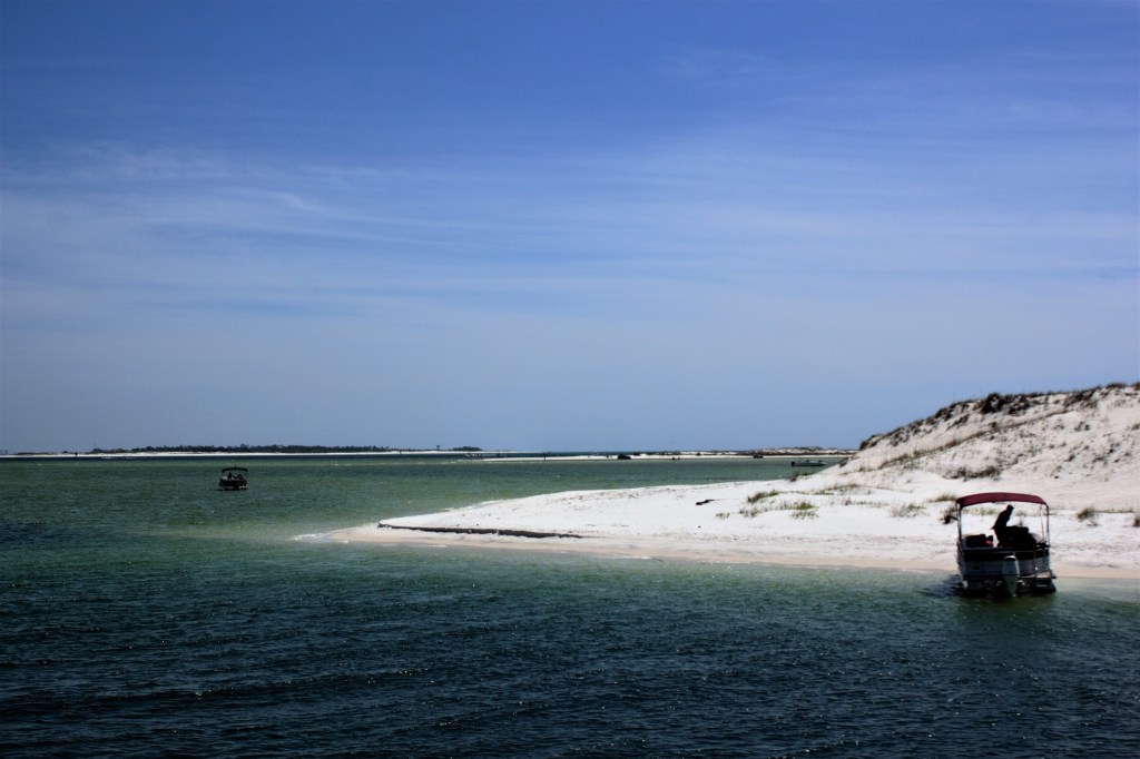
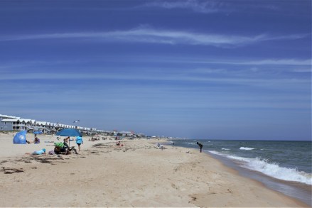
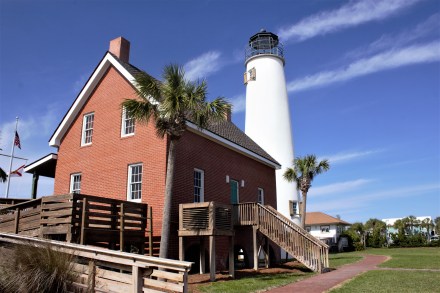
Apalachicola had a taxi company, but it only had one taxi, operated by a husband and wife team. Fortunately, it was available, and able to take us out to St George’s Island, a barrier island reached by two very long bridges and a long causeway. I wanted to go to the beach.

One of the bridges to St George’s Island

It wasn’t quite the deserted paradise I’d imagined, being fairly heavily developed, but there was plenty of space on the beach for everyone. There was a tiki bar too, so instead of enjoying the unspoilt scenery, we had a beer instead, and a paddle.

On the beach at St George’s Island
Beach houses
St George’s Island Lighthouse

We had to sit out a day of bad weather, before leaving for Carrabelle, which was where we would start our crossing of the Gulf of Mexico.

Ingram Bayou to Pensacola and Destin

There was bad weather looming, but we had a beautiful day travelling along the Intracoastal Waterway through the lovely Perdido Bay and Big Lagoon. Before we left Ingram Bayou, we were entertained by some dolphins diving and splashing not far from us.

Dolphins at Ingram Bayou

Big Lagoon separates Perdido Key, the long barrier island, from the mainland. The dark blue water contrasted against the white sand, which is composed mainly of quartz crystals, washed down from the Appalachian Mountains in another age.

Big Lagoon
Perdido Key
Houses on Big Lagoon


The area was first inhabited by the Pensacola people, and was settled in 1559 by the Spanish. Now, it’s a seaport and has a US Naval Air Station which is the home of the Blue Angels, which just happened to be practising as we approached Santa Rosa Island.

Ingram Bayou to Destin

We booked into the Pensacola Shipyard and Marina at Warrington to sit out the bad weather which was approaching. The next four days were going to be fairly bad, really bad, a brief respite, and then bad again. As the next day looked like the least awful day, we decided to hire a car to do a little sightseeing and shopping before the onslaught.

Carina at Pensacola

Ian has been such a good customer of Enterprise Car Hire that we were due a free hire, which cheered us up a bit. We decided to go to see Fort Pickens, strategically placed at the western end of Santa Rosa Island, where there is also an Aquatic Preserve. Unfortunately, some human error had crept into the satnav-programming operation and it was some time before we realised that we had driven 20 miles in an easterly direction, and would have to turn around and drive all the way back again.

Eventually we found the right bridge leading to Pensacola Beach and Santa Rosa Island. By this time it was windy and raining. and the high rises, beach houses, bars, restaurants and condos looked rather dispiriting in the greyness. The road narrowed to a single track as it continued for several miles along the spit of land to the promontory where the fort was. On either side were dunes and grasses, and we had glimpses of the sea. Despite the bleak scene, I would have liked to stop the car to take photographs, but by this time we were within the Reserve boundary and stopping wasn’t permitted.

Fort Pickens was built in 1834 and remained in use till 1947. During the Civil War it was a Union stronghold. In its day it had been extensive, but it had been neglected and allowed to fall into disrepair, before being placed on the National Register of Historic Places.

Fort Pickens, Pensacola
Reinforced concrete

There were impressive archways and brickwork, and one part of the fort had been added in the 1890s and constructed of reinforced concrete. It must have been one of the earliest uses of reinforced concrete, and Ian could not resist inspecting it closely.

Wild flowers grew among the ruins. This is Tradescantia ohiensis, or Confederate Spiderwort.

Tradescantia ohiensis (Confederate Spiderwort)

We didn’t really make the most of Pensacola. There was a restaurant with live music just down the road, but we couldn’t be bothered going out in the wind and rain. The next day was even worse, and rather than venturing out to see the historic town centre, our activities were confined to checking the engine, and making forays to the laundry in between the squalls and thunderstorms.

A short break in the weather the next day allowed us to get to Fort Walton, where there is a free dock next to the public park.

We briefly ran aground while trying to get onto the slip, but Ian has had practice at getting out of this particular difficulty, and the usual manoeuvre of reversing at high revs once again extricated us from an embarrassing situation. We had been seen by some local guys whose sailboat was in one of the slips, and they helped us tie up along the end of the dock, away from the shallow water.

Unfortunately, there was a problem. As well as the usual piles to tie up to, there some extra ones on the outside, which resulted in a 4′ gap between the boat and the dock. I couldn’t put my foot down on our step, while at the same time keeping a hold of the deck rail.

There was no way I was going to take a flying leap from the boat, despite the disparaging comments from some quarters and the amusement afforded to the guys who had helped us dock.
We needed groceries, and Ian had to go to Publix by himself.


The proposed leap

Ian had no such qualms. He was quite happy to stride, no hands, from the boat to the dock and back again.

There was a police presence in the park, and Ian had to report to them when we got there. It might have been reassuring to have them there, but actually it wasn’t. We couldn’t help wondering what went on, that needed them to be there, especially as in the early evening, our friends next door vacated their slip and anchored out, a few yards away, before returning to the dock the next morning.

The police, though, were assiduous in their duty. At 6.30 the next morning, just as I was making the first cup of tea of the day, a knock on the cabin window had Ian leaping out of bed. The police just wanted to point out that we were tied up next to the pump-out, and were we going to use it.

We managed to get to Destin, where there is a natural harbour off Choctawhatchee Bay, before the next bout of bad weather hit us. We anchored there and were able take the dinghy to go ashore to go out for lunch at Gilligans and get an Uber to the supermarket. Things have certainly become easier since the advent of Uber, and the supermarket, Winn Dixie’s, was the best we’d been in for quite a while. They had proper cheese from a farm in Wisconsin, and a fish counter, so for the first time this trip I was able to cook fresh fish for dinner.

Destin from the harbour, with the dinghy dock on the right