Michigan City to Chicago and on to Peoria


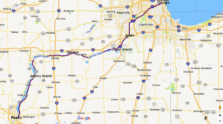
Chicago to Peoria

Chicago to Peoria

Just when you imagine that you’ve got the knack of this boating business, and that nothing could possibly go wrong, events prove otherwise.

IMG_0008Approaching Chicago

Approaching Chicago

IMG_0017Approaching Chicago


IMG_0019Monroe Harbor, Chicago

Monroe Harbor, Chicago

As we got closer to Chicago and the skyline loomed stark against the grey clouds that were building up, I thought about all the wild, beautiful places we had seen on this part of the trip – the wilderness of the North Channel, the beauty of Grand Traverse Bay, the dunes and the attractive towns and villages we had visited along Lake Michigan’s Eastern shore.

But approaching a great city from the water moved me in a quite different way, as I thought of all the history, the struggles and endeavours of past and present generations that any big city represents.

These lofty thoughts quickly dispersed when we had to address the practicality of mooring Carina in Monroe Harbor. I was already feeling queasy from taking photographs with Carina rocking about in the increasing swell. We had pre-booked a mooring – H19. It wasn’t easy to read the small numbers on the balls, but we found it. Ian brought Carina round into the wind and I grabbed the eye of the ball with the boat hook, expecting the ball to lift out of the water so I could attach a line. But nothing happened and with Carina being blown backwards, it took all my strength to keep my grip on the boat hook. Ian came down but there was no way we could reach down 8 feet to get a line attached. To add to the drama, Ian sustained a deep 2-inch gash to his thumb from something sharp on the boat hook, and this had to be quickly dressed before he could radio  for help. The harbourmaster very obligingly came out straight away, took a line off us and attached it to the ball. He reassured us that it wasn’t our fault – our foredeck was simply too high above the water to reach down. We later learned that there are little ‘hats’ which fit over the mooring balls and which make the operation easier, but you have to reserve them in advance. And also that we could have done it from the swim platform at the back of the boat, if the dinghy hadn’t been restricting our access.

The plan for the evening had been to get a water taxi and go for dinner at the Chicago Yacht Club. But Monroe Harbour is quite open to the lake, and the harbourmaster had told us there was a storm coming. The waves had been steadily increasing as we approached Chicago, but I had hardly noticed, amid the stress over the mooring ball and the lacerated thumb.

But as soon as we were safe, and the engine turned off, I realised that I really felt quite ill and spent the rest of the evening lying in my darkened cabin, while Ian got his own dinner. I  was able though to emerge at nightfall for a few minutes to take some more photographs.

IMG_0022Evening, Monroe Harbor

Monroe Harbor, Chicago

IMG_0026nighttime

The next morning, the wind had changed direction, all was calm, and the sun came out.

We had already decided that we would press on to Peoria where we were going to leave the boat till next year, and save the Chicago sight- seeing till we come back next Spring. It was only a short distance to the Chicago Lock and the start of the Sanitary and Ship Canal.

IMG_0029Monroe Harbour

Monroe Harbor, Chicago

IMG_0031Monroe Harbour

Monroe Harbor, Chicago


IMG_0032Monroe Harbor

IMG_0034Near the lock

IMG_0033Monroe Harbour

Chicago Lock

Start of the Sanitary and Ship Canal

Leaving Chicago Lock

It wasn’t long before we left the glitzy high-rise and passed through the outer industrial areas.

Amtrak Railroad Lift Bridge

Graffiti

Sand and gravel

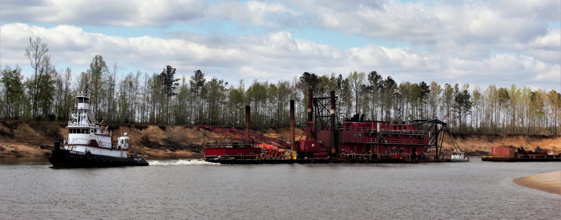
We were completely unprepared for the size of the industrial barges, which are a frequent sight. There was no doubt about who had right of way. How the captains actually steer the things remained a mystery.Barge

Handling the boat in the locks wasn’t a problem. There are large bollards which move down as the boat goes down, and it was easy to just place the midline around it. But pleasure craft play second fiddle to all the commercial boats and we had lengthy waits in places.

Lockport Lock

Lockport Lock was built in 1910 to control the flow of water from Lake Michigan and the Sanitary & Ship Canal into the Des Plaines River.

At one point, not far from Joliet where we planned to tie up, we heard a coastguard announcement over the radio to the effect that a fish barrier was in operation, and the river would be closed for three hours, until 6 o’clock. The fish barrier passes electric current through the water and repels the fish, and prevents Asian Carp from getting into Lake Michigan. We had no choice but to tie up against a high, rough concrete wall, and lassoing the cleat was certainly more of a challenge than managing the bollards in the locks.

In the event, we didn’t have to wait till 6 o’clock before they let us go through, and got to Joliet well before dark. A fellow-boater called Don helped us tie up on the town dock wall, where there was even free electricity.

Evening sun, Joliet

Don said we should stay another day, because the next night there was going to be a concert in the park, followed by a firework display. We ‘d had three hard days of travel since leaving St Joseph, so we didn’t need a lot of persuading to have a break. The following afternoon, we thought we would have a look at Joliet downtown, across the bridge from the mooring. Although there were lots of people driving round in cars, there was no-one actually walking on the streets. The absence of other people was slightly unnerving, and as there was an absence of coffee shops as well, we turned round and had a cup of tea and a cookie on the boat instead.

People did come out for the fireworks though, setting out chairs in the riverside park next to the dock. We had a great view from the boat.

IMG_0005Joliet

Fireworks at Joliet

IMG_0020Firework

IMG_0021Firework

IMG_0039Firework

IMG_0045Firework

South of Joliet, the Des Plaines River meets the Kankakee River to form the Illinois River, widening out and running alongside a series of lakes. There were still locks to contend with.

IMG_0047Brandon Lock

Brandon Lock

IMG_0051McKinley IslandDEs Plaines River

McKinley Island Des Plaines River

After a few nights in marinas and on the town wall at Joliet, it was time for a quiet anchorage at Sugar Island.

IMG_0053Mooring at Sugar Island

Evening at the anchorage at Sugar Island

The next morning I woke up very early and took a few more photographs.

IMG_0004SugarIsland

Early morning Sugar Island

IMG_0007Sugar Island

A few minutes later

Looking north, a fine shaft of sunlight gradually lit up the water.

IMG_0008Sugar Island

Early Morning Sugar Island

Our next stop was Ottawa, but a few miles before we got there we had to negotiate Marseilles Lock. This was not difficult in itself, but a very large barge travelling north had got there before us. There were so many barges linked together that it couldn’t all fit into the lock at the same time. So half of it came up  first, and waited at the top of the lock. The sensible thing would have been for the lockmaster to tell the barges to move forward enough to let the pleasure craft get into the lock and go down, while it was being emptied. But he didn’t, and left us, and several other boats, waiting in the pound while the lock emptied and the rest of the barge came up. Having initially been told our wait would be 20 minutes, we actually waited over two hours.

IMG_0022Marseille Lock

Waiting at Marseilles Lock with the barges blocking our access

But Heritage Harbor Marina at Ottawa was very nice. Jeremy, the harbor master, was helpful and friendly, we used the courtesy car to go to the laundromat and do the shopping, and then we had a swim in the pool. Then we had a nice meal at the Red Dog Grille, in the marina grounds. On the way back to the boat we chatted to Frank, one of the local boat owners. He commiserated over our experience with Marseilles Lock, which is apparently notorious.

IMG_0025Leaving Heritage Harbor Ottawa

Leaving Heritage Harbor Ottawa

IMG_0026Illinois River nezr Ottawa

Illinois River near Ottawa

IMG_0028Abraham Lincoln MemorialBridge JonesvilleIL

Abraham Lincoln Memorial Bridge, Jonesville

There was still some industry here and there.

IMG_0029Barge being unloaded at Hennepin Power Station

Barge being unloaded at Hennepin Power Station

Our last night before reaching Peoria was at Henry Island. We had decided by this time we would fly to Virginia from Chicago to see the family again, and needed good wifi to book the tickets. We had to find a cafe where we could avail ourselves. The only place that seemed suitable was Hennepin, where apparently there was a wall where you could tie up. The only snag was that having tied up, it was quite a step up to the top of the wall, and then you had to scale a two-bar metal fence with very unfavourable curvature, to access the town.  Spratt’s Tap was the first establishment we came to, and I felt after my fence-climbing efforts I needed and deserved a beer, though Ian stuck to lemonade. For some reason the laptop wouldn’t connect to the guest wifi, and after a very frustrating and stressful hour spent trying to book the tickets on my phone, Ian had to ask the owner if we could possibly use the private wifi. No problem, he said, another of the many kindnesses we have been shown on this trip.

IMG_0032Leaving Henry Island

Leaving Henry Island

Henry Island was a beautiful place for our last anchorage. The next day we reached National Marine at Peoria and spent a day packing everything up before leaving for Chicago. We’ll be back in the spring of 2018 to continue our journey south on the rivers.


Saugatuck, St Joseph and Michigan City

Saugatuck to Michigan City

Saugatuck to Michigan City

Saugatuck was not quite like the other harbours we had stayed in. Rather than the approach being along a short, straight channel, the village is a mile from Lake Michigan, and you pass along the gently curving Kalamazoo River, surrounded by wooded hills before you reach Saugatuck itself, and then the river opens out into the expanse of Kalamazoo Lake. Originally a lumber town, Saugatuck re-invented itself as an artists’ colony and tourist destination. One of the restaurants boasts of being one of Hemingway’s favourite hang-outs.

We chose to stay at Tower Marine, which is on the opposite side of the lake from Saugatuck itself, in Douglas, mainly because of the swimming pool, which we even got to use, despite some stormy weather. The marina was well-run and attractively landscaped.

IMG_0027swimming pool and garden, tower marine

Swimming pool and rock garden, Tower Marine

IMG_0026water lilies

Water Lilies

Saugatuck/Douglas has two excellent public transport facilities. One is the famous Saugatuck Chain Ferry, which crosses the river, and the other is the Inter-urban Bus. You ring up the bus and tell it where you want to go, and in no time it appears. We used it a couple of times to get back from the supermarket, and from Saugatuck back to the marina.

We walked from the marina down to the ferry to go across to Saugatuck.

IMG_0001On the Chain Ferry

On the Chain Ferry

IMG_0006Chain Ferry

Chain Ferry

The walk turned out to be rather longer than we had anticipated, and we were in need of coffee. The nearest place was Ida Red’s Cottage, which Kim had recommended, but it was full and there was a long queue of people waiting for tables. Then Ian noticed a sign saying that there was no queue for seats at the bar – it was first come first served. There were two seats, so we took them. We had already eaten breakfast on the boat, but when we saw what everyone else was having, we thought we would have some too – waffle and eggs for Ian, and amazing blueberry pancakes for me.

IMG_0004Ida Red's

Ida Red’s Cottage


A small park in Saugatuck

The Christian Science Church, Saugatuck

Butler St

A small memorial garden on Butler St

Butler St

Inter-urban bus stop and Information Centre

The bus

Baldhead Mountain sounded like an irresistible challenge, even if in reality it was only a big sand dune. But you do have to climb 282 steps to get to the top of it. We cycled to the steps and toiled to the top, where there was a good view of Saugatuck and Kalamazoo Lake, but surprisingly not of Lake Michigan, which was obscured by trees.

The stairs to Baldhead Mountain

Saugatuck from Baldhead Mountain

Opposite the steps is the old Saugatuck Pump House, now a museum.

Saugatuck Pump House

Saugatuck from the Pump House

Riverside Garden at the Pump House

We cycled half a mile over the peninsula to Oval Beach.

Oval Beach, Lake Michigan

We left very early the next morning, with heavy, threatening thunder clouds to the north of us. But I was assured that they weren’t coming our way, and we got to St Joseph in bright sunshine.

Leaving Saugatuck

West Basin Marina, St Joseph

We don’t often have days when we do nothing boat -related, or  that doesn’t involve chores like grocery shopping or laundry. But we took a day off in St Joseph, and it felt like being on holiday. The marina was a couple of miles from downtown St Joseph, and Justin, one of the dockhands, would take us there and bring us back when we summoned him.

He dropped us off at the Maids of the Mist Fountain, at the end of Bluff Park, which is a half-mile long linear park which overlooks Lake Michigan and the site of the Silver Beach Amusement Park, which operated between 1891 and 1971 and was one of Michigan’s biggest tourist attractions, with rollercoasters, carousels and a dance hall.

IMG_0002Maid of the Mist

Maids of the Mist

Maids of the Mist was made for the World’s Fair in Chicago in 1873, and brought to St Joseph in 1892 after being purchased by a St Joseph businessman.

IMG_0003View from Bluff Park

View from Bluff Park, overlooking the site of Silver Beach Amusement Park

We walked to the end of Bluff Park, past a series of War Memorials dedicated to the memory of all those American citizens who lost their lives in  20th century conflicts.

IMG_0008 1st World War Memorial

First World War Memorial

.

IMG_0007

Second World War

At the end of Bluff Park we turned towards the town and a couple of blocks later, came upon some seniors demonstrating outside the office of Fred Upton, their Republican Senator.

IMG_0011Seniors protesting

Seniors protesting

IMG_0013Charles Porter

It was Election Day in St Joseph. A few blocks further up the street, we talked to Al DiBrito, who was hoping to be elected to one of the 3 posts of City Commissioner.

IMG_0014Election

Al DiBrito

It later transpired that he didn’t get in, which seemed a shame. He had appeared like a nice guy.

IMG_0017State St

State Street

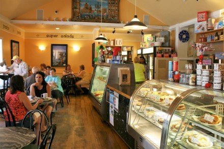
We wandered round the tree-lined streets and decided to have lunch at  Caffe Tosi, where we also found some rather good pear and almond tarts to take back to the boat.

IMG_0018Caffe Tosi

Caffe Tosi

The marina was only 5 minutes’ walk from the lake shore, so after Justin had picked us up and brought us back, we sat on Tiscornia Beach for a couple of hours.

IMG_0024Tiscornia Beach

Tiscornia Beach

IMG_0025Tiscornia Beach

Tiscornia Beach

We were only two days away from Chicago. We stopped at Michigan City, Indiana, and I was surprised to see that the clock said it was 6.30 and my phone said it was 5.30.  At some unspecified point on Lake Michigan, we had unknowingly crossed into Central Time, and it felt strange, like stepping into another country.

We needed groceries and the nearest store was over 3 miles away, too far to bike. There were no Uber cars available. A taxi would take 20 minutes to arrive. After three-quarters of an hour we were still waiting in the marina forecourt, and a very kind fellow-boater gave us a lift to the store in her car. Fortunately, by the time we’d finished the shopping, the run on the taxis had eased and one came straight away to take us back to the boat.

IMG_0030St Joseph Light house

St Joseph Lighthouse

The following day, we left for Chicago.


Lake Michigan’s Eastern Shore: Manistee to Grand Haven

There was a small window of fine weather which allowed us to move on before the next storm hit us, so we left Manistee and travelled down to Pentwater, where we arrived just as the heavy clouds were gathering.

Big Sable Point 

The next day, we were able to nip out to the local supermarket a couple of blocks from the marina,  in between the downpours. By evening, the sky had started to clear a little with the promise of a better day ahead.

Sunset at Pentwater


Morning at Pentwater

Manistee to Grand Haven

Dunes near White River

White River Light Station

We turned into White River which leads into White  Lake, and stayed at Crosswinds Marina at Whitehall.

We’ve found that after bad weather, the next most common cause of delay on the trip is mechanical breakdown. It had been a particularly hot day, so it was doubly annoying that it should be at this moment that Carina’s air-conditioning system stopped functioning. However, Paul from Crosswinds was able to sort this out for us the next day.

But things got worse. Ian noticed while checking the engine that the fresh-water pump wasn’t working. A new one was fedexed up from Virginia and arrived the next day, a Saturday,  but couldn’t be fitted by Paul till Monday.

The new one turned out to be faulty, so another one had to be sent. This time Ian fitted it himself, having watched Paul do it the previous day.

But Whitehall wasn’t a bad place to be held up. There was a cycle track which followed the route of an old railway line, and which led to the supermarket, a mile away  in adjacent Montague, so shopping was quite pleasant. Across the road from the marina, a footpath had been laid which wound up the slope to Whitehall downtown amid a sea of wild flowers.

The wild flower path, Whitehall

Montague was celebrating its 150th anniversary and on the Friday evening we went to watch the Cruz-in vintage car parade, when about 400 old cars slowly drove from Whitehall downtown along the lake shore to Montague. The town had thoughtfully provided folding chairs for spectators. Anyone who doesn’t like old cars, scroll down now.


After 400 cars, I was beginning to feel a little overwhelmed with gasoline exhaust fumes, but it was still quite an occasion.

The next day I persuaded Ian that cycling 7 miles to Montague beach, and 7 miles back, was a good idea. About half the distance was on a cycle track through woodland, and more pleasant than the other half, which was a fairly busy road. When we got to the beach, and saw the lake, we were quite glad we weren’t boating. We watched with interest as several boats had a rocky experience passing through the channel.

Big waves at Montague beach

Big waves in the channel, White River

Our departure was planned for late afternoon, and the idea was to anchor a few miles away in White Lake, near the channel, ready for an early start onto Lake Michigan the next morning.  I was slightly surprised when we seemed to be heading out of White Lake, and into the channel. It seemed there had been a unilateral change of plan. The waves on Lake Michigan apparently weren’t too bad after all, and we were going to Muskegon, 13 miles down the coast. Was that alright? As long as you’re not expecting dinner any time before 9.30, I said.

On the way to Muskegon

From the mooring at Muskegon

IMG_0013Muskegon Light tower

Muskegon Light tower

IMG_0015Grand Haven Lighthouse

Grand Haven Lighthouse

At Grand Haven we stopped on the dock wall on the Grand River for a couple of hours, before going through to Spring Lake, where John and Kim had very kindly invited us to stay on their dock for the night. The town dock was very busy and we were lucky to be able to tie up there – the town was preparing for the annual  Coastguard Festival the following weekend.

IMG_0019USCG Mackinaw eady for the festival

USCG Mackinaw ready for the festival

IMG_0022Ready for the Festival

Ready for the festival

IMG_0004Fast food

Fast food

IMG_0005Coastguard City

Coastguard City

Later, we went out for dinner with John and Kim and their neighbours Rick and Sue – it was lovely to have some company and we had a great time with them.

The next day we set off in light rain for Saugatuck. There was a large vessel, the Wilfred Sykes, occupying the channel, but fortunately she was busy unloading something at the wharf and was stationary, so the problem of not getting in her way didn’t arise. According to Duluth Shipping News, “The Wilfred Sykes was built by Inland Steel in 1949 in Lorain, Ohio. At 678 feet long, she was, when launched, the longest boat on the Great Lakes, setting many cargo records in her first year of operation. She received a new paint job just before the 2016 season, hopefully a good sign for her continued work on the Great Lakes.”

IMG_0014Wilfred Sykes

Wilfred Sykes

The sky had a pink glow, perhaps a portent of the bad weather to come, but we got to Saugatuck and safely docked in the marina before the storm.

IMG_0015Pink cloud on the way to Saugatuck

Pink Cloud on the way to Saugatuck

Lake Michigan’s Eastern Shore: Northport to Manistee

Lake Michigan has toughened us up. The criteria for whether we venture out or not have shifted to the right. The terms and conditions have changed from ‘we will venture out only when wave heights are two feet or less’ to ‘we will venture out as long as the furniture upstairs isn’t actively moving of its own volition across the boat’. I’ve reframed Carina’s pitchings and lurchings by imagining I’m on some marine fairground ride, which clearly I’m supposed to enjoy. Otherwise, it would probably have taken us a year to get down to Chicago.

Ian was anxious to make some progress in that direction, so when the weather improved we made a very early start from Northport, to travel 60 miles down the coast to Frankfort.

Sunrise at Northport

Northport to Manistee

Michigan’s coastline has spectacular sand dunes, the largest fresh water dunes in the world, formed from glacial activity 16,000 years ago. In parts they are covered with trees and grass, and elsewhere the golden sand is exposed. After we rounded the tip of the Leelanau Peninsula after leaving Northport, we got our first views of the Sleeping Bear Dunes, and later, North and South Manitou Islands, which are part of the Sleeping Bear State Park. A low haze hung over the water, so we didn’t see the dunes quite at their best.

I was sorry we didn’t have time to visit the Manitous. John had lent us a book about the history of  North Manitou, by Rita Hadra Rusco, who had gone to live there in 1942. Her book, North Manitou: Between sunrise and sunset, tells the story of the pioneers who lived on the island during the 19th and 20th centuries, the harsh conditions they endured, and the small community that grew up there, only to eventually leave the island for ever in the late 70s, when the island was taken over by the National Parks Service. Houses and land were compulsorily purchased, and most of the buildings demolished. Rita’s plangent sentence “It is as reprehensible to ignore the island’s human history as it would be to desecrate a prime wilderness” seemed to summarise her sadness that a unique way of life had vanished, and her frustration that this had not been recognised by the Parks Service in its zeal to establish a wilderness area.

Low mist on Lake Michigan

Near Frankfort

The sky began to lighten as we neared Frankfort

The harbours on Lake Michigan’s eastern shore are situated around inlets and rivers which feed the main lake. The State has a programme of harbour development and supports the local communities by providing facilities for boaters at the municipal marinas.

At Frankfort, the marina was full but we were able to anchor in the channel and take the dinghy to go ashore for a meal and have a look round the busy town. Like many places, the waterfront was attractive with a pretty garden area overlooking the channel.

Waterfront gardens at Frankfort

.

We left the next day for Manistee, where the lighthouse heralds the entrance to Big River and Manistee Lake beyond it. In Dozier’s Guide to the Waterways, it advises that ‘….if a crew change is necessary, airlines and buses serve Manistee.’ But Ian obviously felt I would do, for the time being.

The dunes near Manistee

Manistee Lighthouse


100 years ago, Manistee was an industrial centre with saltworks, an iron works and lumber factories, and large ships would come up Big River to transport goods. It had the largest number of millionaires per capita in the world. Some fine houses and other buildings are their legacy, and although the downtown has a number of boarded up premises, and Oleson’s the only decent supermarket has recently closed, the main street, overlooking the river, is attractive. The old shop fronts have been retained and there are hanging baskets and small gardens everywhere. The south bank of the river, where the municipal marina is, has a boardwalk leading to the beach and that too is attractively landscaped.

River St. Manistee, showing the former drugstore, now the museum

River St Manistee

Hanging baskets


In the morning, I went in search of groceries. Family Dollar, on the opposite bank of the river, did have milk and orange juice but perhaps unsurprisingly,  no fresh fruit, vegetables or meat. Miller’s produce store and another shop selling ‘organics real food’ were both closed at 9.45 on a Sunday morning. Feeling a little frustrated, I walked back along River Street, and a young woman said hello to me as she turned to open Glenwood Market, a shop which I had noticed the previous day, but which I had assumed sold only jams, cookies and other gift items. But it turned out they sold freshly made bread too, of various types. The one I chose was a potato/rosemary sourdough and after weeks of packaged supermarket bread, it was a luxury. And that was not all. They had fruit pies too. It took me a few minutes to decide that a large, 3-berry pie (cherry, raspberry and blueberry) would not take up too much space in our small refrigerator, that spending $13.50 on a pie was not wildly extravagant, and that we would manage to eat it all. We did, and it was worth every cent.

We had hoped to leave later in the day and make some progress. We left the dock, cruised down the river past the lighthouse, and out into the lake. Two minutes later we turned back. The dockmaster said she wasn’t surprised we had returned. We went out and walked along River Street and consoled ourselves with some wine-tasting at Gardner’s, the outlet for the Douglas winery and invested in some very good Michigan Pinot Grigio.

The strong winds continued so we had another day to explore Manistee. We went to the Manistee County Museum, and were given a conducted tour by Ray, who not only told us what everything was, but demonstrated how many of them actually worked. Most of the exhibits had been donated by local residents and gave a fascinating insight into the history of the area and how people lived. The building was originally Lyman’s Drugstore, and when the business closed in the 1950’s, the family donated the building and contents to the town.

Inside the museum

Ray and the chocolate-dispensing bicycle

The bicycle originally dispensed cigars. Coins would be put in at the top, causing the wheels to turn round and a number would randomly come up. This would determine the number of cigars dispensed. Later, when it became an attraction for children, it was altered to dispense chocolates.

model covered wagon

Old pharmacy relics

Upstairs, rooms were given over to displays of local businesses which had thrived in the past.

photography exhibit

In the afternoon we cycled a few miles north to the Audubon bird sanctuary at Bluff Lake. We didn’t see any birds, but the lake looked spectacular and the waves reminded us why we weren’t actually boating.

Lake Michigan at Bluff Lake Bird Sanctuary

Lake Michigan at Bluff Lake Bird Sanctuary

Wedding Anniversary!

It was our 47th wedding anniversary and in the evening we had  good meal at the Bluefish Bar and Grille, overlooking Big River.